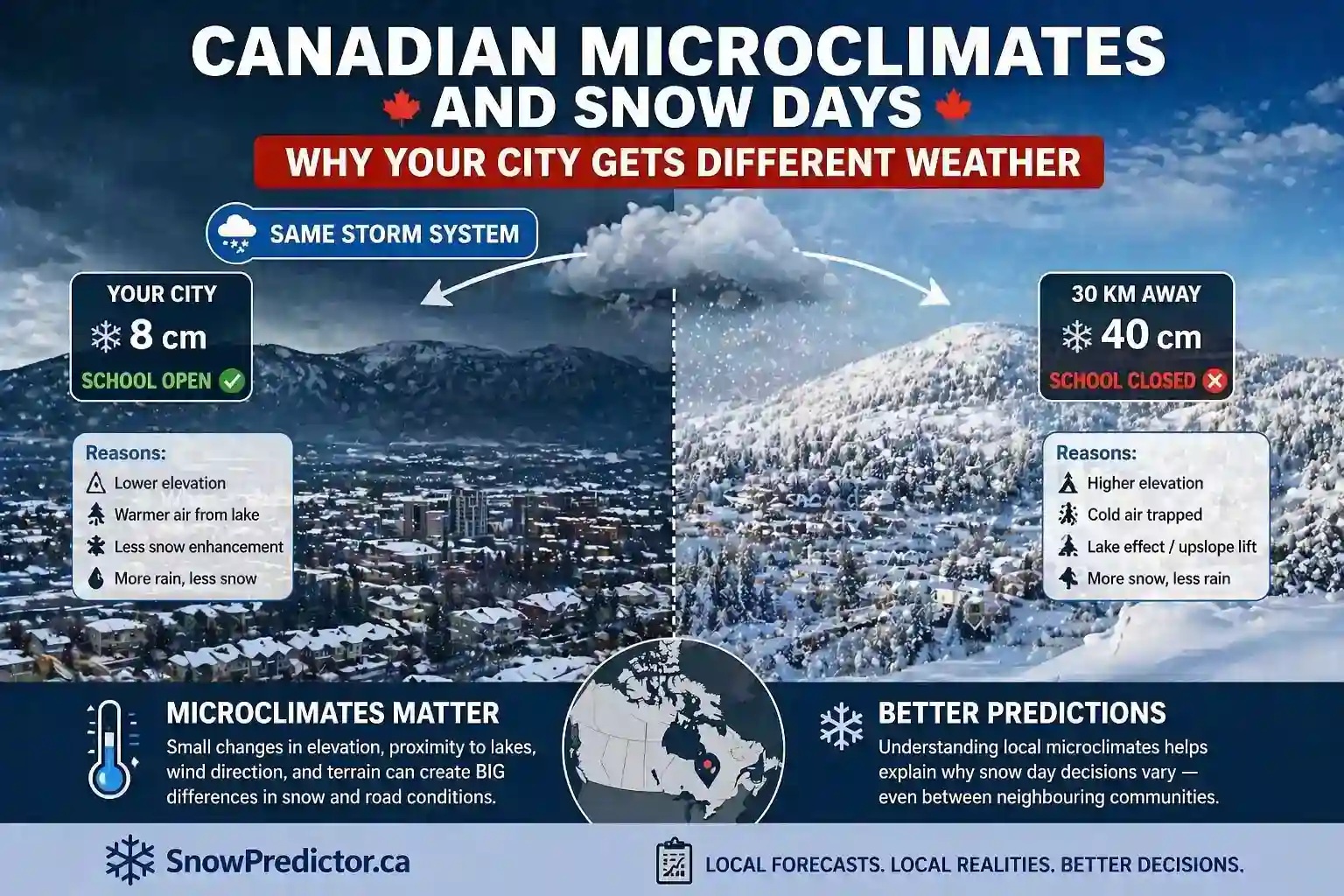
Microclimates Snow Days Canada: Why Nearby Cities Differ
One city wakes to wet roads while another community 30 kilometres away is digging out. One school board continues normally, but a neighbouring transportation authority cancels every bus. These differences can occur under the same regional storm because local geography changes how winter weather develops and where its strongest impacts land.
Understanding microclimates snow days Canada patterns helps explain why a province-wide forecast is rarely enough for planning a school morning. Lakes create narrow snowbands, hills force air upward, valleys trap cold air and coastlines alter temperature and precipitation type. Urban development can create another local contrast.
This guide explains how Canadian winter microclimates affect snowfall, ice, visibility and transportation risk, why nearby cities can receive different snow day probabilities and how families should use local forecasts before an official school decision.
What Is a Winter Microclimate?
A microclimate is a localized area with weather conditions that differ from its surroundings. It may cover part of a city, valley, lakeshore corridor or snowbelt and affect temperature, snowfall, wind, ice or visibility.
Microclimates in Canada are shaped by several features working together:
- Proximity to the Great Lakes, oceans or other large water bodies
- Elevation and slope direction
- Mountains, escarpments and river valleys
- Prevailing wind direction
- Forests, open farmland and urban development
- Existing snow and ice cover
- Distance from local weather stations
A microclimate does not produce the same weather every day. Its effect becomes important when a larger weather system interacts with local geography. Changing wind can move a lake-effect band, while a small temperature increase can turn freezing rain into ordinary rain.
How Microclimates Affect Snow Days in Canada
The connection between microclimates, snow days and Canada’s winter weather becomes important when local conditions affect buses, staff travel, walking routes or building access.
| Microclimate Driver | Local Weather Effect | Possible School Impact |
|---|---|---|
| Open lake water | Narrow, intense snowbands | Rapid road accumulation and poor visibility |
| Higher terrain | Enhanced snow on windward slopes | Difficult hill routes and uneven totals |
| Valley location | Colder trapped air and fog | Localized freezing rain or black ice |
| Coastal exposure | Rapid precipitation changes and strong wind | Mixed snow, rain, ice and drifting |
| Open farmland | Greater blowing and drifting snow | Unsafe rural bus routes |
| Dense urban area | Warmer surfaces and extensive road treatment | Different conditions from outer suburbs |
These effects explain local snowfall differences, but snowfall depth is only one factor. A lightly covered rural road with severe drifting can be less safe than a well-plowed urban road after heavier snow.
Microclimates and Snow Days Around the Great Lakes
Lake-effect snow develops when cold air crosses comparatively warmer, open lake water. The air gains heat and moisture, helping snow develop downwind. Wind direction, water temperature, ice coverage and the distance travelled across open water influence where the strongest bands form.
The Georgian Bay Snowbelt
The Georgian Bay snowbelt includes communities around and southeast of Georgian Bay that can receive intense, localized snowfall. Barrie, Collingwood, Midland and nearby rural communities may experience heavy snow while locations farther south receive much less.
This pattern makes lake-effect snow Ontario forecasts difficult to summarize with a single regional snowfall total. A changing wind can move a narrow band between communities, while falling and blowing snow can rapidly reduce visibility.
Route geography also matters. Conditions in central Barrie may not represent long, exposed roads elsewhere in Simcoe County’s transportation area.
The guide to lake-effect snow and school closures explains why band location, snowfall rate and visibility may matter more than a broad daily accumulation.
Lake Huron and Lake Erie Corridors
Lake Huron and Lake Erie can also create localized snowbands when wind and temperature conditions are favourable.
The area receiving the heaviest snow changes with wind direction, so simply living near a lake does not guarantee heavier snowfall during every event.
Risk can also decline when lake ice limits available moisture. Instead of assuming a traditional snowbelt will always receive the worst conditions, families should check wind direction, band location and storm timing.
Higher-Elevation Microclimates and Snow Days in Canada
Higher terrain can force moist air upward. As the air rises, it cools and may produce additional precipitation on windward slopes. This contributes to orographic snowfall Canada patterns.
Niagara Escarpment
The Niagara Escarpment stretches across southern Ontario from the Niagara region toward the Bruce Peninsula. Elevation and slope exposure can contribute to Niagara Escarpment snowfall differences between higher communities and nearby lower-elevation areas.
Hamilton, Milton and Orangeville do not experience every winter storm in the same way. Wind direction, temperature and storm track determine where enhancement develops.
School authorities covering both lakeshore and elevated routes can therefore face significantly different conditions within the same operating area.
Mountain and Interior British Columbia
In British Columbia, Pacific moisture can produce heavy precipitation on windward slopes while neighbouring valleys receive different amounts or precipitation types.
Rain at a lower elevation may become snow, freezing rain or ice at higher points along a transportation route.
A city-level forecast may therefore fail to represent a school bus route that crosses higher terrain. Families should check forecast zones, elevation and road information rather than relying only on conditions reported at the nearest airport or downtown weather station.
Valley Microclimates and Canadian Snow Days
Dense cold air can move downslope and collect in lower terrain during calm conditions. This process is known as cold air pooling.
When warmer air remains above the colder surface layer, a valley temperature inversion can develop.
A valley community may remain below freezing while nearby higher terrain rises above 0°C. Precipitation can therefore freeze on contact in one location while falling as ordinary rain only a short distance away. Fog and black ice may also remain longer in sheltered low areas.
River valleys in southern Ontario and interior British Columbia can experience these contrasts.
For school transportation, localized ice can become a serious problem. A forecast showing little or no snow may still create cancellation risk when valleys, bridges and untreated roads freeze during morning transportation hours.
Atlantic Canada Coastal Microclimates and Snow Days
Atlantic storms frequently bring snow, rain, freezing rain and strong wind within the same system. Storm track and the location of the rain-snow boundary determine where disruption becomes greatest.
Atlantic Canada winter storms can affect Nova Scotia, New Brunswick, Prince Edward Island and Newfoundland and Labrador differently. Exposed coastal areas may experience stronger wind and faster precipitation changes, while inland or elevated communities remain colder and snowier.
This coastal winter weather can create several school-day hazards:
- Heavy, wet snow that is difficult to clear
- Freezing rain near changing temperature boundaries
- Strong wind and drifting across exposed routes
- Coastal rain changing to inland snow
- Rapid changes in visibility
- Power outages affecting individual school buildings
Halifax, Sydney, Moncton, Charlottetown, Corner Brook and St. John’s should not be treated as one winter forecast area. Their terrain, geography and storm exposure differ.
The Atlantic Canada storm day guide explains how these regional weather differences interact with local school decisions.
Prairie Microclimates, Wind and Drifting Snow
The Prairies do not have the same Great Lakes and coastal terrain patterns, but their open landscape creates another important local winter effect.
Strong winds can redistribute loose snow across roads, reduce visibility and rebuild drifts shortly after plows pass.
Sheltered urban streets may appear manageable while exposed routes outside Calgary, Edmonton, Regina, Saskatoon or Winnipeg remain hazardous. Tree lines, road orientation and subtle changes in terrain can produce substantial differences within the same transportation network.
This is another reason microclimates snow days Canada predictions cannot depend only on new snowfall totals.
Blowing snow combines wind with existing or falling snow. The blowing snow and visibility guide explains why rural transportation can be disrupted even when little new snow is forecast.
Urban Heat Islands and Suburban Winter Differences
Buildings, roads and other artificial surfaces absorb and release heat differently from natural land. This creates the urban heat island effect.
An urban heat island winter effect can contribute to warmer city-centre temperatures and surfaces compared with surrounding rural or suburban areas. Traffic, road treatment and snow-clearing resources can widen the operational difference.
However, this effect should not be oversimplified.
A warmer downtown temperature does not prove every urban road is safe, and a suburban community is not automatically snowier. Elevation, storm track, wind and precipitation type may outweigh urban warming during a particular event.
Why Nearby School Boards Can Make Different Decisions
The relationship between microclimates snow days Canada and school operations becomes especially clear when neighbouring school authorities make different decisions during the same storm.
One board may operate mainly within a dense urban area. Another may serve rural roads, hills, shorelines and communities separated by long distances.
Even when their regional forecasts appear similar, transportation exposure and operating conditions can differ significantly.
That is why school closures in Canada cannot be predicted using one national or provincial snowfall threshold.
Officials may consider:
- Current and expected road conditions
- Snowfall or ice during transportation hours
- Visibility on exposed routes
- Municipal snow-clearing progress
- Reports from bus contractors or route inspectors
- Building access, staffing and power
- Expected conditions during afternoon dismissal
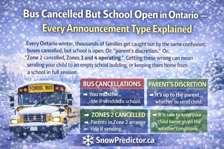
Also remember that school bus cancellations do not necessarily mean school buildings are closed. Families should read the complete official notice.
How SnowPredictor Should Handle Canadian Microclimates
A useful Canadian snow day predictor should begin with location-specific weather instead of applying one provincial forecast to every community.
It should consider:
- Precipitation type
- Snowfall amount and rate
- Storm timing
- Wind
- Visibility
- Temperature changes
- Local geographic exposure
These signals can help explain why neighbouring communities receive different snow day estimates.
However, no public system can represent every hill, road, elevation or narrow lake-effect band. Claims of exact microclimate adjustments or guaranteed corrections require documented methodology and validation.
Use SnowPredictor.ca for a local snow day forecast, then compare the result with current weather and road conditions.
For snow day prediction Canada, the final authority remains the relevant school board, school division or student transportation organization.
How Families Should Compare Local Snow Day Predictions
When neighbouring locations display different percentages:
- Confirm both predictions refer to the same school date.
- Check whether the locations belong to different school authorities.
- Compare snowfall, ice, wind, visibility and storm timing.
- Look for a lake, elevation change, valley, coastline or exposed rural corridor.
- Recheck the forecast if a narrow snowband or freezing line may shift.
- Verify the official decision for your school and transportation zone.
Do not replace your local result with a nearby major city simply because that city receives more weather coverage. The geographic feature between the two locations may be exactly why their conditions differ.
Frequently Asked Questions
What Is a Winter Microclimate?
A winter microclimate is a local area where temperature, snowfall, wind, icing or visibility differs from surrounding locations because of water, terrain, elevation, vegetation or built infrastructure. Its influence changes with the larger weather pattern.
How Do Microclimates Affect Canadian Snow Days?
They can concentrate snow, trap cold air, increase icing or worsen visibility along particular routes. Nearby school authorities may therefore face different transportation conditions during the same regional storm and reach different operational decisions.
Why Can Nearby Canadian Cities Receive Different Snowfall?
Wind direction, lake exposure, elevation, terrain and precipitation type can change over short distances. Narrow lake-effect bands around the Great Lakes are a clear example because one community can receive heavy snow while another remains outside the band.
Does More Snow Always Mean a Higher Chance of Closure?
No. Ice, wind, visibility, timing, road treatment and route exposure can matter as much as snow depth. A smaller freezing-rain or blowing-snow event may disrupt transportation more than a larger, manageable snowfall.
Can a Snow Day Predictor Account for Every Microclimate?
No. Location-specific data can improve planning, but no public predictor can represent every road, elevation or narrow band. Always confirm the final status through your school board, school division or transportation authority.