High Wind Warning Canada: When Wind Can Cancel Buses Without Heavy Snow
Canadian parents may expect school bus cancellations only when roads are covered in snow or ice. Strong winds create a different school-travel risk by pushing large vehicles across lanes, breaking branches, damaging power lines and exposing children at roadside stops. This high wind warning guide explains how Canadian wind alerts work, why buses may be cancelled on a dry day and what families should check before leaving home. The Canada Snow Day Predictor can support early planning, while official weather, transportation and school-board notices provide the final operating information.
What the Alert Means for Canadian Families
The phrase high wind warning Canada is commonly used in searches, although Environment and Climate Change Canada generally calls the land-based alert a Wind Warning or Warning – Wind. It is issued when sustained winds or damaging gusts are expected to threaten public safety, travel, property or utilities.
The high wind warning meaning is not simply that the day will feel breezy. For school travel, the notice does not automatically close buildings or cancel transportation. It tells families and officials that wind impacts require local assessment. This distinction matters for families.
| Question | Practical Answer |
|---|---|
| Is this the usual Canadian alert name? | The official land alert is generally called a Wind Warning. |
| Can buses be cancelled without snow? | Yes, when routes, stops or vehicle control become unsafe. |
| Does bus cancellation mean schools are closed? | Not always; transportation and building decisions may differ. |
| What should parents check? | Weather, bus, board, road and utility updates. |
Why Wind Can Stop Buses on Clear Roads
A school bus has a tall body and large side surface. Crosswinds can push against that surface on open highways, bridges, rural roads and exposed hills. Sudden gusts may require quick steering corrections when a bus moves from a sheltered street into an open area.
Wind also creates hazards outside the vehicle. Falling branches, damaged signs, loose construction materials and downed wires may block roads or make stops unsafe. Transportation providers may review:
- Wind direction and gust strength
- Exposed bridges and open farmland
- Tree-lined roads and overhead wires
- Construction areas and loose objects
- Vehicle type and route length
- Bus-stop and school-loop conditions
- Forecast winds near dismissal
The complete route matters more than conditions outside one home.
Why Buses Face More Risk Than Family Cars
A passenger car may make one short journey on a treated main road. A bus covers many kilometres, makes frequent stops and cannot avoid every secondary road or exposed section.
High-profile vehicles are more sensitive to crosswinds. Gusts can affect lane position, especially when passing gaps between buildings, leaving wooded areas or meeting large trucks. Students may also need to stand near traffic, cross roads and board while carrying bags.
Strong winds can affect doors, unsecured belongings and student balance. A route manageable for a small car may therefore remain unsuitable for a bus. This difference helps explain why school bus cancellations can be announced even when families see ordinary traffic moving nearby.
School Closures and Bus Decisions Are Separate
Environment and Climate Change Canada issues the weather alert. Transportation providers decide whether buses can operate, and school boards decide whether buildings open.
Possible outcomes include:
- Schools and buses operating normally
- Selected routes cancelled
- Transportation cancelled by weather zone
- All buses cancelled while schools remain open
- A delayed opening
- Selected schools closed
- District-wide closure
- Early dismissal if conditions worsen
A board may keep schools open when buildings are safe and accessible, even though exposed routes are cancelled. It may close schools when wind causes widespread road hazards, structural concerns, utility loss or unsafe access.
Families must read their own board’s announcement rather than copying the decision of a neighbouring district.
How Dry Roads Can Still Become Dangerous
High winds can push debris into traffic, break trees, damage power lines and disable traffic signals. A road does not need snow or ice to become unsafe.
Crosswinds are often strongest on bridges, elevated roads and open land. Tree-lined routes may face falling limbs, while urban streets can collect bins, signs and construction material. Loose snow from an earlier storm may create sudden visibility problems.
This is why snowfall totals alone cannot predict transportation decisions. A dry day with damaging gusts may create more operational risk than a calm day after several centimetres of cleared snow.
Understanding Yellow, Orange and Red Wind Alerts
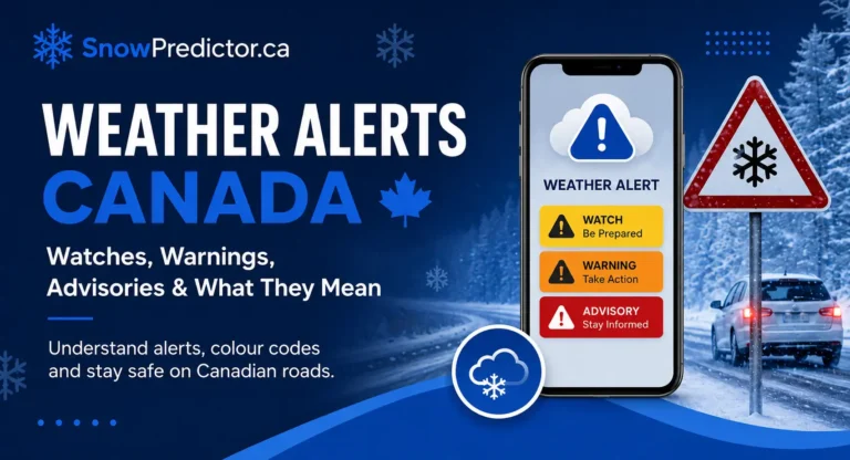
Canada assigns yellow, orange or red colours to formal warnings, advisories and watches. The colour reflects both forecast confidence and expected impact.
Yellow Warning – Wind
Yellow generally indicates moderate, localised or shorter-term impacts. Broken branches, brief utility interruptions and flying debris may still affect travel or individual routes.
Orange Warning – Wind
Orange indicates a higher risk of major or widespread disruption. More extensive outages, snapped trees, roof damage and dangerous travel may occur.
Red Warning – Wind
Red is reserved for rare, extreme and potentially life-threatening events. Long outages, structural damage and extensive tree loss may be expected.
A yellow alert can still make one exposed bus route unsafe. Families should read the colour, location, timing and full impact statement together.
The Canadian weather alerts guide explains the colour system and the difference between warnings, watches, advisories and statements.
Wind Warning, Watch and Advisory Compared
| Message | What It Means | Family Response |
|---|---|---|
| Warning – Wind | Dangerous or damaging wind is occurring or expected | Act and reconsider unsafe travel |
| Watch | Severe weather could develop | Prepare and monitor updates |
| Advisory | Significant but generally less severe weather is expected | Take precautions |
| Special Weather Statement | Extra information about unusual or concerning conditions | Read for context and continue checking |
Canada weather alerts may also mention wind within a winter storm alert, thunderstorm warning or special statement. The full notice identifies the main hazard.
The weather advisory versus warning guide explains alert urgency in more detail.
How Local and Toronto Searches Should Be Checked
A high wind warning Ontario search does not mean every community in Ontario faces the same conditions. The province contains many forecast regions, and wind direction, terrain, trees and local exposure can change impacts.
People searching wind warning Toronto should confirm the exact forecast region and issue time. Toronto may receive a wind alert while nearby communities have a different colour or no warning.
A high wind warning today result may remain visible after an update or expiry. Open the newest official notice rather than relying on a headline, screenshot or notification preview.
A high wind warning near me search can also be misleading near forecast boundaries. Confirm the community named in the alert and compare it with the school and travel route.
Why Power Outages Matter to Schools
Wind warning power outages can affect heating, lighting, internet, water systems, traffic signals and communication. Even when roads remain open, a school may be unable to operate safely if a building loses essential services.
Families should charge phones, prepare flashlights and keep paper copies of school and emergency contacts. Utility maps help show known outages, but they do not confirm whether a school is open.
The power outage preparation guide explains safe lighting, heating, food storage and communication planning.
Never approach fallen electrical lines. Keep children and pets away, report the hazard and follow utility or emergency instructions.
How Boards Assess Wind Risk
School systems may review official forecasts, observations, road information, bus-contractor reports and utility conditions. They also consider whether winds could strengthen near dismissal.
A rural district with exposed highways may respond differently from an urban board with sheltered routes. Tree cover, bridge exposure, building condition and overhead utilities can also change risk.
A Reliable School-Morning Checking Routine
Read the Official Weather Notice
Check the colour, issue time, affected region, expected peak winds, wind direction and listed impacts.
Check Transportation Separately
Confirm whether the child’s route, zone or entire system is cancelled. Check whether morning cancellation also applies in the afternoon.
Check the School Board
Verify whether the school is open, delayed, closed or changing dismissal time. A bus notice does not always answer the building-status question.
Review Local Hazards
Look for fallen branches, damaged lines, blocked roads, unstable trees, traffic-signal outages and loose objects around the stop or walking route.
Plan for the Return Trip
Wind may strengthen after classes begin. Confirm pickup arrangements and keep notifications enabled.
The weather app versus school-board notice guide explains which source should answer each part of the decision.
Preparing the Home Before Strong Winds Arrive
Bring loose outdoor items inside or secure them. Move vehicles away from weak branches where practical. Charge phones and power banks, prepare flashlights and check smoke and carbon monoxide alarms.
Keep children away from trees, damaged structures and downed lines. Trim or repair hazards only when conditions are calm and qualified help is available.
A household should also prepare for short or extended utility loss. The winter emergency kit Canada guide lists water, food, warmth, medication, communication and vehicle supplies.
Driving in High Winds
Driving in high winds requires slower speed, more space and careful steering. Postpone unnecessary trips when debris, closures or vehicle-control problems are reported.
When travel is essential:
- Keep both hands on the wheel
- Reduce speed before exposed sections
- Leave extra space around buses and trucks
- Expect gusts on bridges and open roads
- Avoid stopping near trees or unstable signs
- Watch for utility and emergency crews
- Never drive around closure barriers
- Carry a charged phone and emergency supplies
Keeping Students Safer at Bus Stops
Students should wait away from traffic, trees, utility poles, construction fencing and loose objects. Backpacks should remain closed and secure.
Parents should remain with younger children when service may be delayed or cancelled. An open school does not make every stop or walking route safe.
Families should assess local hazards as well as the regional forecast. If debris or damaged lines are present, move away and report the danger rather than trying to clear it.
How SnowPredictor.ca Supports Early Planning
The official wind alert explains the weather hazard. The transportation provider decides whether buses operate, and the school board confirms whether buildings open.
The Canadian school closure probability tool supports the period before official announcements by estimating how forecast wind and related conditions may affect school operations.
Families can use the estimate to prepare childcare, work and transportation alternatives. Once an official board or bus notice appears, that notice takes priority.
Frequently Asked Questions
What Is the Definition of a High Wind Warning?
In Canada, the phrase usually refers to an official Wind Warning. It means winds are occurring or expected that could significantly threaten people, property, utilities or travel. Canada uses an impact-based system, so the alert’s colour and full message explain the expected disruption.
Why Is It So Windy in Toronto Today?
The cause depends on the current weather pattern. Strong winds in Toronto often develop when a cold front, low-pressure system or sharp pressure difference moves through southern Ontario. Check the latest official forecast for the present wind direction, gust speed, timing and meteorological explanation.
Is a 40 km/h Wind Gust Strong?
A 40 km/h gust is noticeable and moderately strong, but it is not usually damaging by itself. It can move branches, make umbrellas difficult to control and affect cyclists or high-profile vehicles on exposed roads. Risk depends on duration, direction and stronger surrounding gusts.
Is a Sustained Wind of 20 to 30 km/h Strong?
A sustained wind of 20 to 30 km/h is breezy to moderately strong but is generally not considered severe. It becomes more noticeable in open areas and may affect walking, cycling and high-profile vehicles. Local gusts can be much stronger than the sustained wind.
Can Planes Fly During a High Wind Warning?
Yes. The alert does not automatically close an airport. Decisions depend on wind direction, crosswind strength, gustiness, wind shear, runway conditions, aircraft type and operating limits. Strong crosswinds may cause delays, diversions, missed approaches or cancellations.